Disaster · Before and after
Kakhovka dam, Ukraine
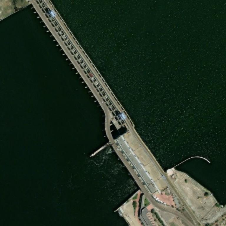
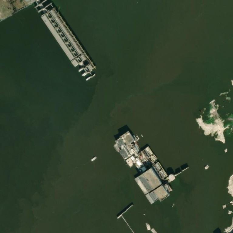
Two dated satellite photos of the same spot, 7 Aug 2022 and 31 Aug 2023. Open them in GeoWhisperer to swipe between them, check the pair and read what changed.
Open this comparisonCompare another place
What changed
Major change. A large section of the dam structure and roadway across cells A2, B2, and C2 is no longer present, leaving open water. The power station facility in cells B2, C2, and C3 is severely damaged, and new exposed land has appeared in cell B3.
- Square A2high confidenceDam structure and roadway no longer presentBefore: A diagonal concrete dam structure carrying a paved roadway across open water. After: The dam wall and roadway are missing, leaving open water.
- Square B2high confidenceDam structure missing and building damagedBefore: Diagonal section of the dam, roadway, and part of the power station complex. After: The main dam wall and road are gone, replaced by open water and damaged building remnants near the bottom.
- Square B3high confidenceExposed ground and vegetation above water levelBefore: Open green-tinted water covering the entire cell. After: A patch of light-colored ground and green vegetation rising out of the water near the right edge.
- Square C2high confidenceRoadway and structure missing or damagedBefore: Curved road section, pier, and building structures linked to the dam. After: The roadway is no longer visible, and remaining structures appear heavily damaged and partially submerged in water.
- Square C3high confidenceShoreline structures damaged and partially submergedBefore: Industrial complex, railway, curved breakwater, and landscaped shore area. After: The curved breakwater and adjacent ground are under water, and the building complex shows heavy damage and debris.
The square is split into nine numbered squares, A1 to C3. The changes above sit in A2, B2, B3, C2, C3.
Differences that are not changes
Things that look different in the two photos but do not mean anything changed on the ground:
- Square A1: Slightly different appearance of remaining structure at top left. Not counted: viewing angle.
- Square B1: Water tint and clarity difference. Not counted: colour balance.
The photos
| Place | Kakhovka dam, Ukraine |
|---|---|
| Coordinates | 46.77750, 33.37060 |
| Before photo taken | 7 Aug 2022 · 0.5 m per pixel |
| After photo taken | 31 Aug 2023 · 0.31 m per pixel |
| Source | Esri World Imagery Wayback (Esri, Maxar and partners) |
| Category | Disaster |
The movie
GeoWhisperer turns this comparison into a short film with numbered markers: watch or download the MP4.
Check it yourself
- This spot on OpenStreetMap
- Sentinel Hub EO Browser, free satellite archive
- Every dated photo of this spot in the Esri archive
The reading above was produced by GeoWhisperer from these two photos and nothing else. It describes what is visible, never why it happened or who did it, and it can miss things or misread shadows, season and viewing angle. Check every line by eye with the slider in the tool. Another OSINT tool by Henk van Ess, www.digitaldigging.org.
← Derna, Libya (dam burst) · Antakya old town, Turkey (earthquake) →