Construction · Before and after
Tesla Gigafactory, Grünheide
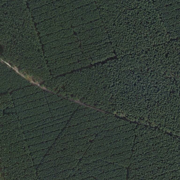
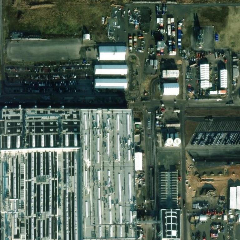
Two dated satellite photos of the same spot, 28 Aug 2012 and 20 Jan 2025. Open them in GeoWhisperer to swipe between them, check the pair and read what changed.
Open this comparisonCompare another place
What changed
Major change. The forest visible in August 2012 has been completely cleared, and a large industrial facility with multi-sectional factory roofs, parking lots, paved yards, and railway infrastructure was built across all cells by January 2025.
- Square A1high confidenceDense forest replaced by cleared grassy land, paved lot, and parked carsBefore: Dense coniferous forest After: Open grassy lot, paved parking area, and rows of parked vehicles
- Square A2high confidenceForest cleared and replaced by industrial warehouses, storage containers, and paved yardsBefore: Dense coniferous forest After: Multiple long industrial white-roofed buildings, storage containers, and paved service area
- Square A3high confidenceForest cleared and replaced by industrial buildings, storage containers, and paved lotsBefore: Dense coniferous forest After: Industrial storage yards, white roofed buildings, and stacked containers
- Square B1high confidenceForest cleared and replaced by a large factory roof structure and paved parking lotBefore: Dense coniferous forest cut by a narrow dirt path After: Large industrial factory roof with solar panels and a paved parking lot with vehicles
- Square B2high confidenceForest cleared and replaced by a white factory roof, service roads, and rail tracksBefore: Dense coniferous forest cut by a diagonal dirt path After: Large light-colored factory roof, smaller buildings, and a parallel rail corridor
- Square B3high confidenceForest cleared and replaced by industrial buildings, parking lots, storage tanks, and roadsBefore: Dense coniferous forest After: Paved vehicle parking lot, cylindrical storage tanks, white industrial buildings, and roads
- Square C1high confidenceForest cleared and replaced by a section of a large industrial factory roofBefore: Dense coniferous forest After: A section of a large factory roof covered with linear solar/skylight structures
- Square C2high confidenceForest cleared and replaced by a large factory roof section and rail infrastructureBefore: Dense coniferous forest After: White industrial factory roof and adjacent railway track corridor
- Square C3high confidenceForest cleared and replaced by industrial canopy structures, open ground, and paved areasBefore: Dense coniferous forest After: Industrial canopy structures, open ground staging areas, and paved internal roads
The square is split into nine numbered squares, A1 to C3. The changes above sit in A1, A2, A3, B1, B2, B3, C1, C2, C3.
The photos
| Place | Tesla Gigafactory, Grünheide |
|---|---|
| Coordinates | 52.39850, 13.79250 |
| Before photo taken | 28 Aug 2012 · 0.30000001192092896 m per pixel |
| After photo taken | 20 Jan 2025 · 0.31 m per pixel |
| Source | Esri World Imagery Wayback (Esri, Maxar and partners) |
| Category | Construction |
The movie
GeoWhisperer turns this comparison into a short film with numbered markers: watch or download the MP4.
Check it yourself
- This spot on OpenStreetMap
- Sentinel Hub EO Browser, free satellite archive
- Every dated photo of this spot in the Esri archive
The reading above was produced by GeoWhisperer from these two photos and nothing else. It describes what is visible, never why it happened or who did it, and it can miss things or misread shadows, season and viewing angle. Check every line by eye with the slider in the tool. Another OSINT tool by Henk van Ess, www.digitaldigging.org.